Which VMAX app should I download (the black or the white one)?Updated 2 months ago
There are two VMAX apps
1) VMAX E-Scooter. For the VX4, New VX4, New VX2 Hub, New VX2 Gear, VX8, VX2 Extreme, R40 Pro and R55 Pro Electric Scooters
2) VMAX Connect. For VX5, VX5 Pro, VX2 Pro, VX3 Pro Electric Scooters
If your display has a big green circle for battery level use get the white "VMAX Connect" app. If your display says “SPEED” over the top of the digital speedometer, use the black "VMAX E-Scooter" app.
The VMAX apps are available for all current iOS and Android smartphones. You can simply download them from the Appstore or Playstore (VMAX-E-Scooter) and Appstore or Playstore (VMAX Connect).
Setup for VMAX E-Scooter app (black)
Map material
You can download the map for your region or next vacation directly in the app when needed. The desired region is requested directly during the initial installation. 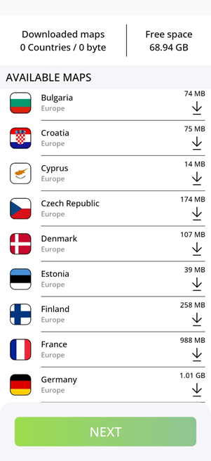
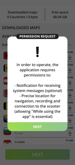
Authorizations
Bluetooth: To connect to your scooter, the app needs authorization to access the Bluetooth module of your smartphone.
Location: The app needs access to your exact position for navigation
Personalization
The app offers customization options for your personal preferences. You can choose between the metric and imperial systems of units.
To calculate an accurate and realistic range for your scooter, the app requires some personal details:
Your gender
Your weight
Your height
Your date of birth.
Connecting your scooter
When pairing your scooter with your smartphone for the first time, the app will automatically detect the scooter’s Bluetooth module.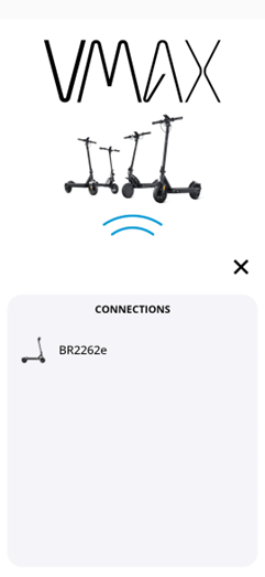
Next, select your scooter model. It is important to choose the correct model to ensure accurate display information and range calculations. Selecting the wrong model may result in incorrect data.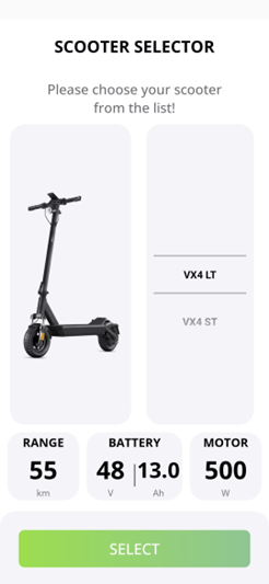
Navigation
In the main menu of the app, you can view your current location along with the current status of your scooter, such as the remaining range and battery charge level.
The app also displays range on the map, taking into account your personal data, altitude, and road quality. 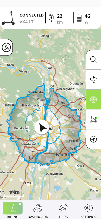
You can easily search for any address or point of interest (POI) within the main menu of the app and start navigation right away. Alternatively, you can select a destination directly on the map.
If the automatic recording of your route is deactivated, you can manually start recording your route from the navigation section.
Settings
The app offers a variety of settings to customize your navigation experience to your preferences:
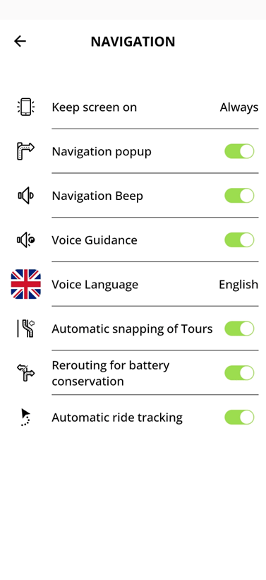
You can choose to keep your screen on for the entire duration of navigation or for the dashboard to display information continuously. If you're using turn-by-turn navigation on your scooter’s display, the screen can also be set to automatically turn off after a period of time to save battery.
You can opt to display pop-up notifications that show upcoming instructions during your ride.
To ensure you don’t miss any instructions, your smartphone can alert you with an audible signal to upcoming instructions.
If necessary, the app can also read out all the instructions.
You can select a separate language for voice navigation instructions, independent of the display language.
When importing a GPX track, you can choose to follow the track directly or have the app align the track with the stored road network.
If the remaining range unexpectedly decreases during your ride, the app can automatically recalculate your route if required.
You can decide whether to record all tours or only specific ones.
Draw and Plan
If you don't want to go with the fastest route to your destination but have a specific route in mind, you can record it on your phone using the “Draw and Plan” function. 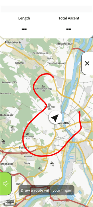
The app then searches for accessible routes on your tour.
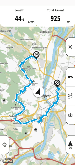
Before you start your tour, you can view all the relevant information about your tour and find the best tour for you.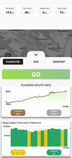
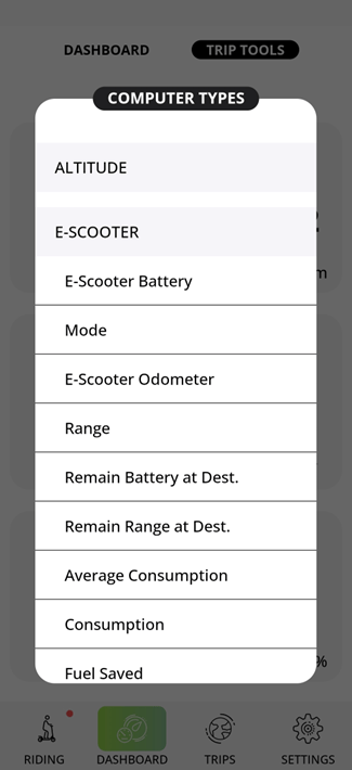
Dashboard
The app features a fully customizable dashboard.
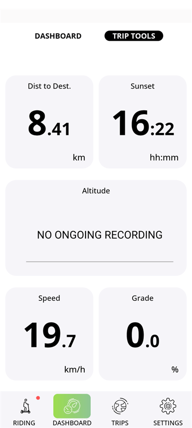 In the dashboard, you can access a variety of information about your current ride and scooter status:
History
In the history section, you will find your recorded trips as well as any imported tours.
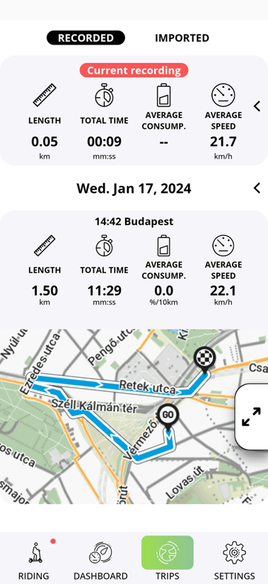
After selecting a tour, you can choose whether you want to ride to the start of the tour or to the nearest point on the route. 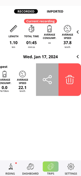
You can easily share your recorded tours via the app. Additionally, you can also easily import tours as GPX tracks from your phone's internal memory.